
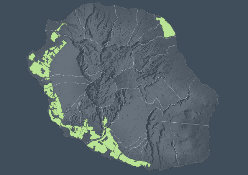
Périmètre du suivi et de l'optimisation des secteurs irrigués en service
Ce périmètre d'étude représente le territoire sur lequel il existe un réseau de livraison d'eau brute en gestion. Ce périmètre est utile au Département pour étudier les évolutions des espaces agricoles et secteurs irrigués. On peut considérer cette surface comme une zone d'observation.
L'objectif de cette donnée est avant tout la protection et l'optimisation des secteurs irrigués et le suivi des évolutions de l'usage de l'eau brute départementale.
|
|
Proposition de citation
(2021) . Périmètre du suivi et de l'optimisation des secteurs irrigués en service. http://41.213.202.31:8080/geonetwork/srv/api/records/8cd4fa81-d97a-4745-879c-0149cb0fc974 |
Simple
- Date ( Publication )
- 2021-04-28
- But
- Etat
- Archivé
A l’origine de
- Fréquence de mise à jour
- Lorsque nécessaire
- Mots clés ( Thème )
-
- eau , eaux
- Mots clés ( Localisation )
-
- brute
- Mots clés
-
- périmètre , secteur
- Mots clés
-
- suivi
- Mots clés
-
- irrigué
- Mots clés
-
- Département
- Mots clés
-
- agricole
- Contraintes d'accès
- Droit d’auteur / Droit moral (copyright)
- Contraintes d'utilisation
- otherRestictions
- Autres contraintes
- Type de représentation spatiale
- Vecteur
- Dénominateur de l'échelle
- 50000
- Langue
- Anglais
- Jeu de caractères
- Utf8
- Catégorie ISO
-
- Limites
- Période
- 2021-02-012021-04-20
))
- Informations supplémentaires
-
You can customize the template to suit your needs.
You can add
and remove fields and fill out default information (e.g. contact
details).
Fields you can not change in the default view may be accessible in the
more
comprehensive (and more complex) advanced view. You can even use the
XML editor
to create custom structures, but they have to be validated by the
system, so
know what you do :-)
- Nom du système de référence
- WGS 1984
- Ressource en ligne
-
eaubrute_niv1_suivi_optim_irrigation
eaubrute_niv1_suivi_optim_irrigation
- Ressource en ligne
-
peigeo:eaubrute_niv1_suivi_optim_irrigation
eaubrute_niv1_suivi_optim_irrigation
- Niveau
- Jeu de données
- Généralités sur la provenance
gmd:MD_Metadata
- Identifiant de la fiche
- 8cd4fa81-d97a-4745-879c-0149cb0fc974 XML
- Langue
- Anglais
- Jeu de caractères
- Utf8
- Date des métadonnées
- 2025-08-25T08:17:40
- Nom du standard de métadonnées
- ISO 19115:2003/19139
- Version du standard de métadonnées
- 1.0
Point de contact
Aperçus
Fourni par
