
Keyword
Elevation
15 record(s)
Type of resources
Available actions
Topics
Keywords
Contact for the resource
Provided by
Years
Representation types
Update frequencies
Status
Scale
-

Le trait de côte ou la ligne de rivage est la limite géographique entre mer et terre. Il correspond d’après le SHOM à « la laisse des plus hautes mers dans le cadre d'une marée astronomique de coefficient 120 et dans des conditions météorologiques normales (sans phénomène de surcôte). Le trait de côte tel que défini ci-dessus n'est pas directement repérable de façon continue sur le terrain ou sur une image satellite ou aérienne. Dans une perspective d’étudier le déplacement du rivage des indicateurs permettent d’approcher cette notion (la limite de végétation associée à la limite des infrastructures, le pied de plage,….). Sur le littoral récifal de l’île de La Réunion la limite de végétation et d’infrastructure ainsi que de pied de plage ont été retenue. Cette limite se traduit par la production d’une couche d’information géographique vecteur de type ligne dans un SIG résultat de la photo-interpétration sur les orthophotographies de l’IGN aussi appelées BD ORTHO. La BD ORTHO est une composante du RGE®. Il s’agit d’orthophotographies numériques couleurs fournies au format raster (tiff, ecw,..). Une orthophotographie est une image numérique qui a les mêmes qualités métriques qu’une carte de même projection pour les mêmes éléments au sol. Elles sont disponibles depuis 1997 sur La Réunion avec une répétitivité quinquennale. Leur résolution spatiale est passée de 1 m en 1997 à 50 cm en 2003. UMR Espace-Dev
-

Le profil de plage est une représentation en coupe figurant sa topographie. L’approche par profil de plage ou transect de la topographie d’une plage et de sa dynamique s’illustre par l’acquisition de données altimétriques le long d’un profil fixe. 22 profils sont régulièrement suivis sur le littoral récifal de l’île de La Réunion : 2 profils par an encadrant les saisons de houle de l’été et de l’hiver austral ; l’impact des évènements de fortes houles (cyclones, houles australes) est mesuré systématiquement sur les sites SNO et plus sporadiquement sur les autres sites. La méthodologie déployée localement depuis 2012 mobilise 2 récepteurs Topcon Hiper II (base et mobile) et un contrôleur Topcon FC-250 (carnet de terrain).
-

Le trait de côte ou la ligne de rivage est la limite géographique entre mer et terre. Il correspond d’après le SHOM à « la laisse des plus hautes mers dans le cadre d'une marée astronomique de coefficient 120 et dans des conditions météorologiques normales (sans phénomène de surcôte). Le trait de côte tel que défini ci-dessus n'est pas directement repérable de façon continue sur le terrain ou sur une image satellite ou aérienne. Dans une perspective d’étudier le déplacement du rivage des indicateurs permettent d’approcher cette notion (la limite de végétation associée à la limite des infrastructures, le pied de plage,….). Sur le littoral récifal de l’île de La Réunion la limite de végétation et d’infrastructure ainsi que de pied de plage ont été retenue. Cette limite se traduit par la production d’une couche d’information géographique vecteur de type ligne dans un SIG résultat de la photo-interpétration sur d’images satellites Pléiades. Les images satellitaires Pléiades issues de la base de données Kalidéos Réunion (CNES) sont utilisées depuis 2016 pour étudier la position du rivage annuellement. Lancé en 2011, Pléiades est un système d’images spatiales à très haute résolution spatiale (instrument optique panchromatique à 70 cm et 2,8 m en multispectral) opérant dans le visible et le proche infrarouge avec une fauchée de 20 km UMR Espace-Dev
-
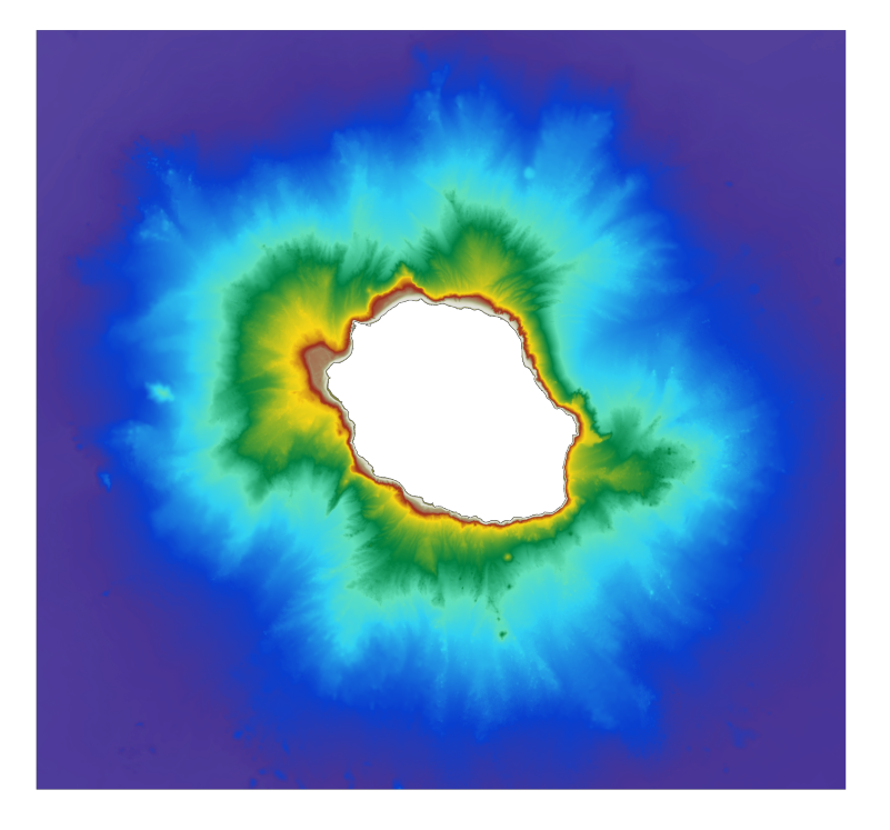
Le MNT bathymétrique de façade de La Réunion à une résolution de 0.001° (~ 111 m) a été réalisé dans le cadre du projet HOMONIM. Il couvre intégralement l'île de La Réunion et s'étend vers le large jusqu'à plus de 4000 m de profondeur. Le MNT est destiné à être implémenté dans les modèles hydrodynamiques afin de produire des prévisions aussi précises que possible des hauteurs d’eau et d’états de mer à la côte et donc d’améliorer la pertinence de la Vigilance Vagues-Submersion.
-

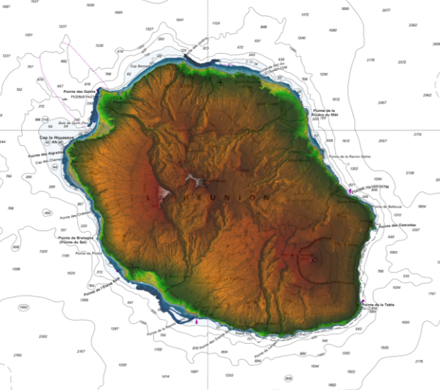
Transect altitudinal sur le flanc Ouest du Piton des Neiges. Mise en place de placettes permanente tous les 200 m d’altitude entre 750 et 2350 m. Différents paramètres abiotiques et biotiques sont observés sur les placettes: - Variables climatiques (T, RH) - Analyses physico-chimiques des sols - Inventaires de végétation, arthropodes...
-

Transect altitudinal sur le flanc Est du Piton des Neiges. Mise en place de placettes permanente tous les 200 m d’altitude entre 350 m et 2950 m. Différents paramètres abiotiques et biotiques sont observés sur les placettes: - Variables climatiques (T, RH) - Analyses physico-chimiques des sols - Inventaires de végétation, arthropodes...
-
Le produit Litto3D est une base de données altimétrique unique et continue terre-mer donnant une représentation tridimensionnelle de la forme et de la position du sol sur la frange littorale du territoire français. Une ligne de partage des zones d'acquisition entre terre et mer, sépare les levés réalisés par les technologies lidar bathymétriques ou sondeur multifaisceau côté mer et lidar topographiques aéroportés côté terre, un recouvrement de 300m étant prévu. Litto3D est disponible sous deux formes : un semis de points tridimensionnels et un modèle numérique de terrain maillé et qualifié.
-
Bathymétrie dans les océans Indien et Atlantique au pas de 1/8 minute d'arc. Ce jeu de données est un Modèle Numérique de Terrain bathymétrique, calculé avec les données bathymétriques du sondeur multifaisceaux de grands fonds EM122 (12kHz) du N/O Marion Dufresne. L'acquisition est faite dans un mode opératoire d'opportunité pendant le transit du bateau. Référence verticale : niveau des mers observé Description de la campagne : LOUBRIEU Benoit, ESCARTIN Javier (2023) TV_LPTBGI 2023 cruise, RV Marion Dufresne, https://doi.org/10.17600/18003354
-
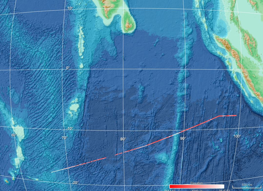
Bathymétrie dans l'océan Indien au pas de 1/8 minute d'arc. Ce jeu de données est un Modèle Numérique de Terrain bathymétrique, calculé avec les données bathymétriques du sondeur multifaisceaux de grands fonds EM122 (12kHz) du N/O Marion Dufresne. L'acquisition est faite dans un mode opératoire d'opportunité pendant le transit du bateau. Référence verticale : niveau des mers observé Description de la campagne : LOUBRIEU Benoit, ESCARTIN Javier (2022) TV_LPTSIN 2022 cruise, RV Marion Dufresne, https://doi.org/10.17600/18003037
-

Bathymétrie du bassin profond de l'océan indien entre La Réunion et le Nord de Madagascar, au pas de 3.75" secondes d'arc (115m environ), synthèse de transits valorisés, août 2023. Ce Modèle Numérique de Terrain, est une compilation de données bathymétriques acquises par sondeur multifaisceaux, au cours de transits pendant des campagnes de la série MAYOBS et autres campagnes scientifiques.. Référence verticale : Niveau des mer observé Description des campagnes : - RINNERT Emmanuel, LEBAS Elodie, PAQUET Fabien, JORRY Stéphan, FEUILLET Nathalie, THINON Isabelle, FOUQUET Yves (2019) MAYOBS, https://doi.org/10.18142/291 - FOUQUET Yves, FEUILLET Nathalie (2019) MAYOBS4 cruise, RV Marion Dufresne, https://doi.org/10.17600/18001238 - RINNERT Emmanuel, THINON Isabelle, FEUILLET Nathalie (2020) MD 228 / MAYOBS15 cruise, RV Marion Dufresne, https://doi.org/10.17600/18001745 - RINNERT Emmanuel, THINON Isabelle, LEBAS Elodie (2021) MAYOBS18 cruise, RV Pourquoi pas ?, https://doi.org/10.17600/18001984 - RINNERT Emmanuel, PAQUET Fabien, LEBAS Elodie (2021) MAYOBS19 cruise, RV Pourquoi pas ?, https://doi.org/10.17600/18001985 - RINNERT Emmanuel, THINON Isabelle, LEBAS Elodie (2021) MAYOBS21 cruise, RV Marion Dufresne, https://doi.org/10.17600/18001986 - THINON Isabelle, LEROY Sylvie, LEMOINE Anne (2020) SISMAORE cruise, RV Pourquoi pas ?, https://doi.org/10.17600/18001331 - BERTHOD Carole, ZARAGOSI Sébastien, FAMIN Vincent (2021) SCRATCH cruise, RV Marion Dufresne, https://doi.org/10.17600/18002274 - LECORRE Mathieu, JORRY Stéphan, CORSE Emmanuel (2022) ECOLE BLEUE OUTREMER 2022 cruise, RV Marion Dufresne, https://doi.org/10.17600/18002499 Les campagnes Mayobs font partie d'une série de campagnes réalisée dans le cadre du réseau Revosima (Réseau de surveillance volcanologique et sismologique de Mayotte : https://doi.org/10.18715/MAYOTTE.REVOSIMA https://doi.org/10.18142/291 : série des campagnes MAYOBS