Topic
biota
116 record(s)
Type of resources
Available actions
Topics
Keywords
Contact for the resource
Provided by
Years
Formats
Representation types
Update frequencies
Status
Scale
Resolution
-

Les observations sont réalisées selon un protocole précis de survol en ULM de la côte ouest de La Réunion, entre Saint-Leu et Saint-Paul (Jean et al 2010). Cette côte est découpée en zones en fonction de la géomorphologie du littoral (géomorphologie comprise entre 0 et 50 m de fond). Ces observations sont ici rapportées en densités par vol et par kilomètre carré, pour chaque année. Ce programme est financé par Kelonia et la Région Réunion.
-
Cartographie de l'abondance relative des différentes espèces de cétacés autour de l'île de La Réunion en 2014 selon une grille de maille 2kmx2km.
-

Les données acquises entre 2001 et 2015 par balise Argos, ont été analysées pour sortir 2 localisations par jour. Le nombre de localisations de Tortues vertes balisées à Mohéli est agrégé par carré de 1° de côté. Ce mode de calcul est celui choisi dans le cadre du projet Mégafaune pour toutes les populations (une espèce, un lieu) étudiées afin de permettre l'inter-comparaison. Ces suivis post-reproduction ont eu lieu dans le cadre des projets "DYMITILE" Kelonia / Ifremer.
-
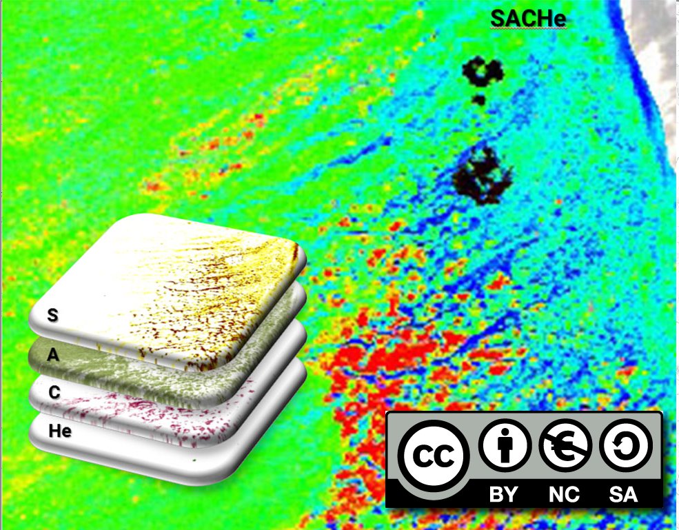
Cette cartographie raster permet de visualiser une synthèse des taux de recouvrements des 4 principaux constituants Sable, Algues, Corail, Herbiers (SACHe) observables sur les 4 grandes plateformes récifales de la côte ouest de l'Île de La Réunion à travers une image en fausse couleur (composition colorée). Cette image est constituée de 4 bandes (une pour chaque constituant), dont 3 sont représentés (sable (Bleu) / algues (Vert) / corail (Rouge) sur une image composite RVB avec un étirement sur la gamme de valeurs comprise entre 0 et 100 %. A l'échelle du pixel, la somme des bandes fait 100 %. Pour le taux de recouvrement des herbiers, seules les zones disposant d'herbiers significatifs sont présentées en échelle de gris.
-
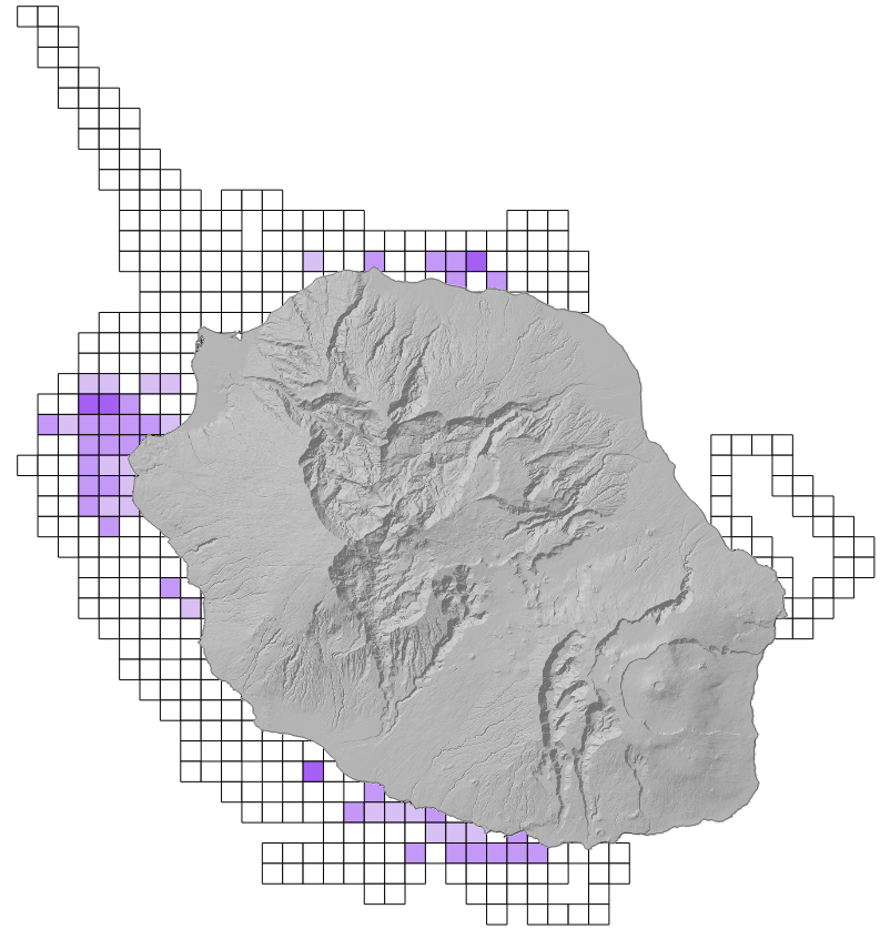
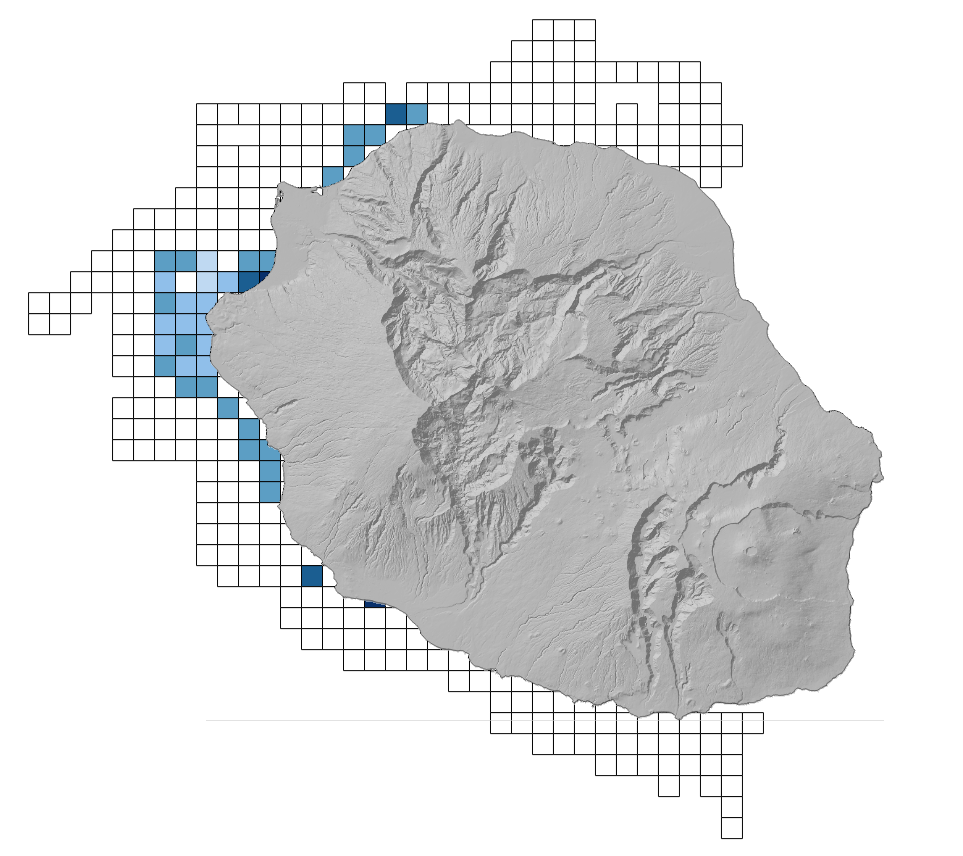
Cartographie des fréquences d'observation des différentes espèces de cétacés autour de l'île de La Réunion en 2010 selon une grille de maille 2kmx2km.
-
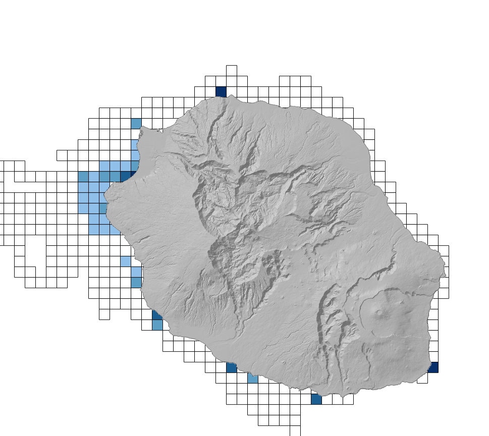
Cartographie des fréquences d'observation des différentes espèces de cétacés autour de l'île de La Réunion en 2022 selon une grille de maille 2kmx2km.
-

Une Zone Naturelle d'Intérêt Ecologique, Floristique et Faunistique (ZNIEFF) est un secteur du territoire national sur lequel les experts scientifiques ont identifié des élements remarquables du patrimoine naturel. Il existe des ZNIEFF de type I et des Znieff de type II. Cette couche est temporairement hébergée sur sextant. Elle sera bientôt accessible sur le serveur de la DEAL Réunion à travers l’outil de cartographie dynamique CARMEN.
-
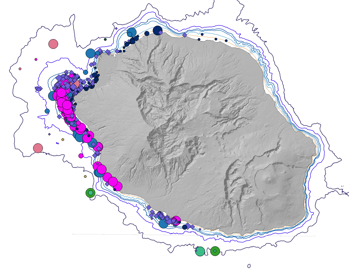
Cartographie des positions des observations des différentes espèces de cétacés autour de l'île de La Réunion en 2012
-
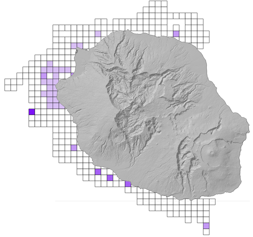
Cartographie de l'abondance relative des différentes espèces de cétacés autour de l'île de La Réunion en 2020 selon une grille de maille 2kmx2km.
-
Les "entités coralliennes" constituent un indicateur spatialisé issu des données de couverture corallienne à haute résolution spatiale (40 cm) obtenues à partir du traitement des images hyperspectrales acquises en Mai 2015 (Projet HYSCORES : Ifremer/UBO/OLE) ainsi qu'en 2009-2010 (Projet Spectrhabent). Cet indicateur a été développé pour faciliter les analyses et les comparaisons spatio-temporelles.